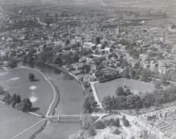
David will demonstrate how to use old maps, historic air photos (this one is from 1921), LIDAR and archives to find and record local features.
Hosted by Bartonsham History Group and Greening the Village, David’s talk will be followed by a guided field workshop to show how to use simple GIS to map our trees, archaeological and landscape features around here. (Date to be arranged).

 RSS Feed
