Bartonsham Row Ditch Project
|
THE ROW DITCH, '(ROWE in some sources)' a Scheduled Ancient Monument, is the remains of a bank and ditch running through Bartonsham Meadows, adjacent to the back gardens of houses on the south side of Park Street. Historic England recognised the feature and because of its condition placed it on the 'At Risk' register in 2013. |
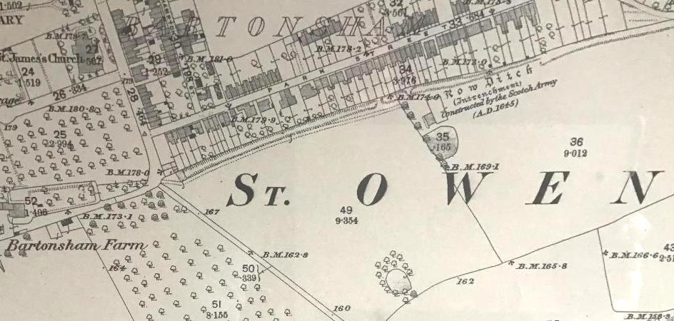
There are references to a 'Rough Ditch' possibly dating back to the reign of Henry II in the mid 12th Century. In the 1880s the first Ordnance Survey map refers to it as '(Intrenchment) Constructed by the Scotch Army (A.D.1645)'. Later suggestions include an association with Offa's Dyke.
The aim of the project is to raise the awareness, public appreciation & understanding of the feature to ensure there is no further degradation of the feature & contribute towards its place in the wider history of the city. A geophysical survey of the feature was undertaken in March 2014 by Headland Archaeology funded by Historic England.
The project received substantial support from Historic England, Hereford City Council, with a generous grant allocation from The National Lottery.
Support was also received from Herefordshire Council, The Woolhope Club, Mr J.Matthews at Bartonsham Farm Dairies (tenant) and the Church of England Commissioners and their agents (land owners).
Following a competitive tendering exercise arranged by Historic England, Herefordshire Archaeology; a department of Herefordshire Council, was selected by the group as project manager under the supervision of Archaeological Projects Manager, Tim Hoverd.
What actually was the Row Ditch?
There have been several suggestions as to what it actually was, but none have been supported by scientific investigation.
- It is referred to as ‘Rough Ditch’ in the Middle Ages, possibly as early as the mid-12th century – the reign of Henry II
- Local antiquarians in the 18th and 19th century thought it might be associated with Hereford’s town defences and it is marked on several early maps
- In the History and Antiquities of the County of Hereford I (1804) John Duncumb suggested that the ditch and its bank ‘had been thrown up as a breast-work during a siege’. This was repeated by the Rev. John Webb in the Civil War in Herefordshire II (1879) who claimed it was built by the Scottish army when besieging Hereford in 1645. He stated that it was 800 yards long and twenty feet high from the bottom of the ditch. The Ordnance Surveyors were influenced by this and it is referred to as an ‘Intrenchment (sic) constructed by the Scotch Army’ on the 25” OS plan of 1887
- In 1901 it was associated with Offa’s Dyke by J. G. Wood who wrote about it in the Woolhope Transactions. This was subsequently accepted by Sir Cyril Fox in his extensive survey of Offa’s Dyke, published in 1955
- More recently historians and archaeologists have been more sceptical and suggest that it was an ancient boundary between the Bartonsham Meadows, which were prone to flooding, and the arable land to the east of the Saxon/Medieval city, called the Portfield. The constant ploughing towards this boundary would have created a prominent bank, which until recently was visible at the bottom of the gardens of the houses in Park Street. The ditch below it may have acted as a ‘carrier’ to drain the water from the meadows towards the Yazor/Eign Brook – now beyond the railway embankment.
The Project
|
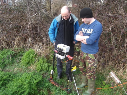
During March 2014, in far from perfect weather conditions, Headland Archaeology, assisted by students from the 6th Form College and members of the 1st Hereford Scout Troop, carried out gradiometer and resistivity surveys on the reputed line of Row Ditch, adjoining the Bartonsham Meadows. (See March 2014: Geophysical Report from Headland Archaeology pdf file). This was financed by English Heritage as a prelude to a community trenching project. The object was (1) to clarify the alluvial geology of the site where the young gravels of the meadows meet the older glacial deposits, which form the light soils of the Hereford Terrace and (2) to identify any anomalies along the route of the ditch such as informal tipping, organised dumping – from the Henry Wiggin site on Holmer Road in the 1960s - and electricity cables. |
|
The site was divided into 20m blocks, with the gradiometer collecting 4 readings from each metre whilst the twin-probed resistivity meter was used at 1 metre intervals. The data was presented diagrammatically in colour by different tonal blocks. The gradiometer recorded much ferrous material located close to the gardens, which was contained within the domestic material that had been dumped since the mid-19th century and, presumably, the Wiggin deposit. It also picked up the route of the electricity cable. There was less magnetic material further out in the meadow, close to the fence. Here the resistivity survey showed high levels of resistance with consistent readings in excess of 130 ohm/m, which suggests the presence of a bank, whilst close to the gardens the readings were generally below 60 omh/m, which, in turn, implies the presence of a ditch.
Consistent levels of higher resistance occur close to Crozen Lane at the east end of the site and, with reservations, the author of the report suggests that there was probably less tipping here and the ditch maybe present to its full extent. For much of its length to the west, behind the houses, the ditch has been encroached upon by the gardens. The appearance of a ditch today beneath the garden boundaries is thus, an anomaly, caused by tipping, and not the historic ditch. Equally the bank to the south of the ditch has only been sporadically preserved. The geology was fairly confused but the ditch was cut into the earlier glacial deposits, whilst the bank was raised-up with the younger river gravels.
So basically Rowe Ditch is not a figment of the antiquarian imagination, picked up by militaristic ordnance surveyors, eager to find Civil War defences, but a real topographical feature 13 metres in width, with the bank on the river-side of the ditch against the arable Portfields. In the age before JCBs, to build this would be a considerable undertaking, and one not carried out lightly.
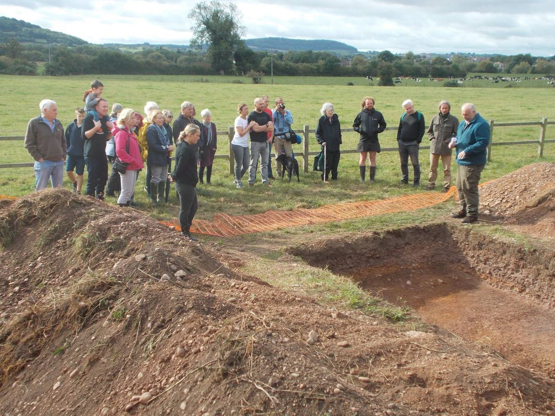
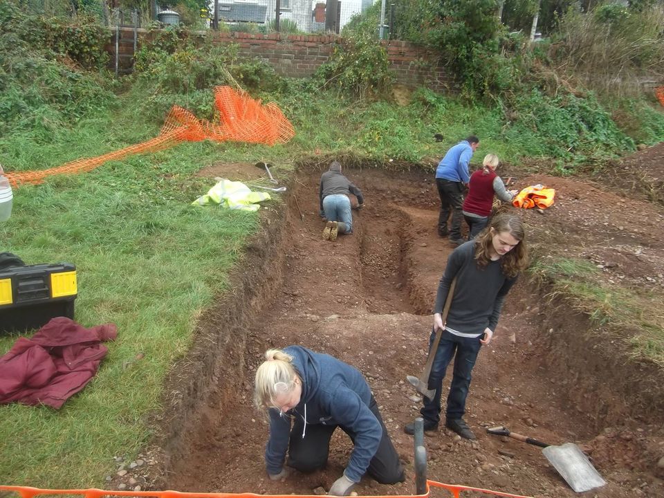
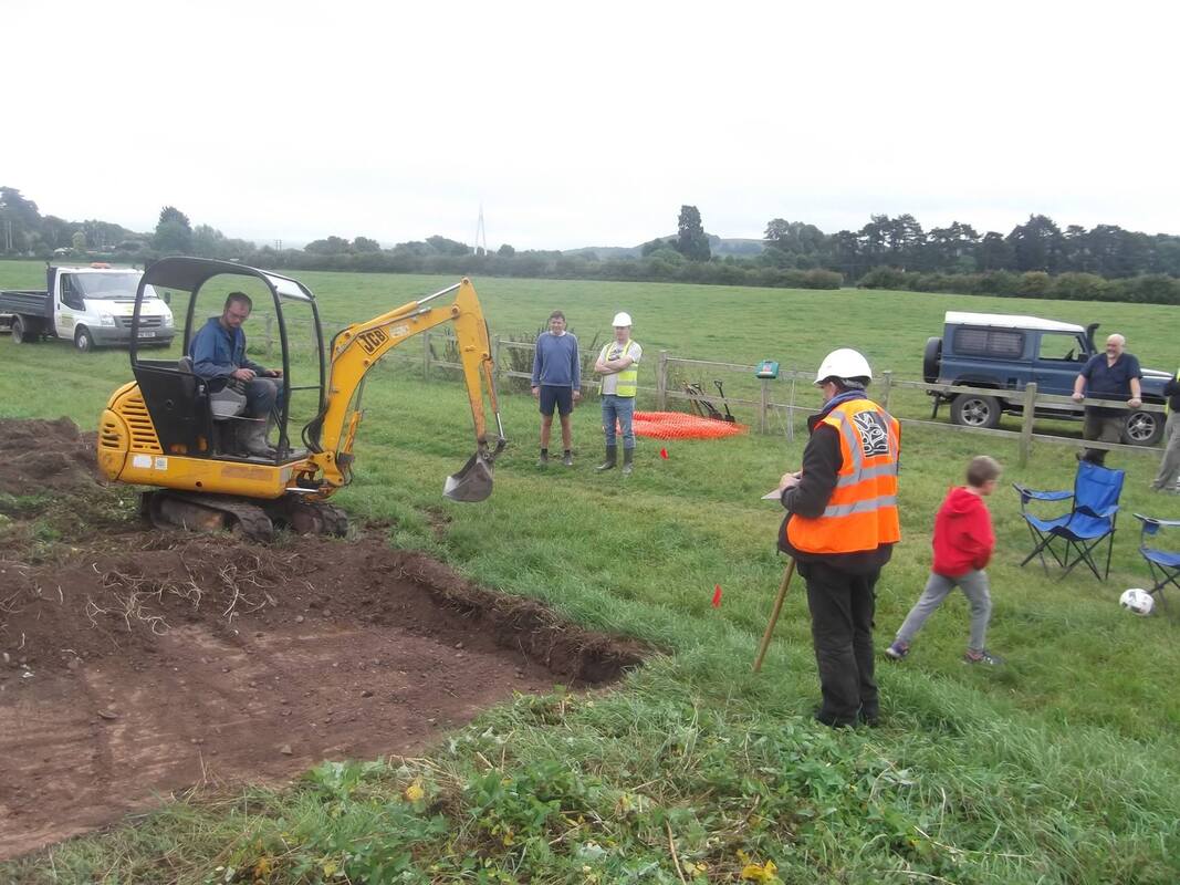
Under Tim Hoverd's expert direction, the topsoil of two trenches were mechanically excavated & then hand dug across the line of the ditch by professional archaeologists & volunteers. The results indicate that the feature is largely natural in origin, being formed by ancient post-glacial river courses known as paleo-channels. However, cuts in the natural gravel levels indicate that a least some of the earthwork may have been enhanced during the 17th century Civil War siege of Hereford.
Consistent levels of higher resistance occur close to Crozen Lane at the east end of the site and, with reservations, the author of the report suggests that there was probably less tipping here and the ditch maybe present to its full extent. For much of its length to the west, behind the houses, the ditch has been encroached upon by the gardens. The appearance of a ditch today beneath the garden boundaries is thus, an anomaly, caused by tipping, and not the historic ditch. Equally the bank to the south of the ditch has only been sporadically preserved. The geology was fairly confused but the ditch was cut into the earlier glacial deposits, whilst the bank was raised-up with the younger river gravels.
So basically Rowe Ditch is not a figment of the antiquarian imagination, picked up by militaristic ordnance surveyors, eager to find Civil War defences, but a real topographical feature 13 metres in width, with the bank on the river-side of the ditch against the arable Portfields. In the age before JCBs, to build this would be a considerable undertaking, and one not carried out lightly.
Under Tim Hoverd's expert direction, the topsoil of two trenches were mechanically excavated & then hand dug across the line of the ditch by professional archaeologists & volunteers. The results indicate that the feature is largely natural in origin, being formed by ancient post-glacial river courses known as paleo-channels. However, cuts in the natural gravel levels indicate that a least some of the earthwork may have been enhanced during the 17th century Civil War siege of Hereford.
|
|
|
Click on pictures to enlarge
The occupation of Bartonsham Meadows by Parliamentary forces during the siege is documented & attested to by finds of artefacts from the period. The relatively small scale of the investigation did not produce any material finds to confirm the use of the Row Ditch, it would seem likely to have been used for defensive purposes given the dynamic response of the town's defenders to the siege in the contemporary reports of sorties carried out against the besiegers.
The enigmatic Row Ditch, such a prominent feature in the area, is now slightly better understood and who knows but further evidence of its history may come to light in the future? Hopefully, the project will help to raise the level of understanding & appreciation of the feature to local residents & visitors alike. With changes coming to the management of the Bartonsham Meadows it is hoped a better recognition of its place in the landscape & protection from misuse in the future will follow.
The enigmatic Row Ditch, such a prominent feature in the area, is now slightly better understood and who knows but further evidence of its history may come to light in the future? Hopefully, the project will help to raise the level of understanding & appreciation of the feature to local residents & visitors alike. With changes coming to the management of the Bartonsham Meadows it is hoped a better recognition of its place in the landscape & protection from misuse in the future will follow.
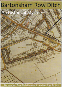
New Row Ditch Booklet
|
|
The group would like to thank Tim Hoverd of Herefordshire Council's Archaeology Department for his
unstinting hard work, support & enthusiasm in bringing the project to fruition.
unstinting hard work, support & enthusiasm in bringing the project to fruition.

