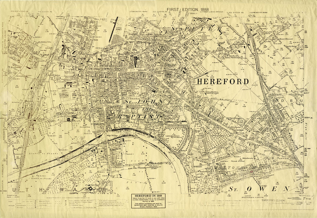
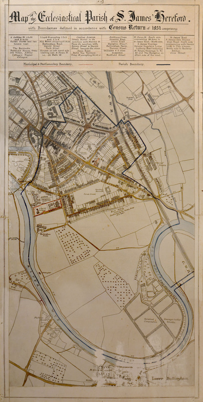
Bartonsham History Group
Like us, follow us, contact us:
  • Home
  • News
  • History of The Meadows
  • Gallery
    • Maps
    • All BHG Activities
    • Places
    • Historical Events
  • Parish History Guide
  • Topics
    • Old Movies
    • Infirmary and Asylum
    • St James' Church
    • The Whalebone Inn
    • Bartonsham Dairy
    • The Bassom
    • Old Barracks
    • War Memorial
    • Benny Hucks, Pilot, Visit 1913
    • St James' School
    • World War II
    • Jane Hayes Almshouses
    • Kyrle Street Cottages
    • Bartonsham's Mills
    • Row Ditch
    • History of Eign Sewage Works
    • History of Our Streets
  • Stories
  • Contact Us
  • Parish History 7 Eign Wharf
  • Parish History 8 Crozen Chapel
  • Parish History 13 Site of St Owens Church
  • Parish History 14 St Owens gate
  • Parish History 15 Saxon City Wall
  • PAVILION Chapel
  • PUBS of StOwen Gate

Maps

Click for a larger version.
1888 map of the city
1931 Parish map
1. Map in two parts from Doug (Park Street). Not sure which years these show but Harold Street shows as Bartonsham Street!
2. Map in two parts from Doug (Park Street). Not sure which years these show but street names are different!
If you have old maps you'd be happy to share, let us know!

Copies of these two maps can be made available to purchase:The 1931 St James Parish map (24”x12”) and the 1888 Hereford map  (24”x16”) Costs: £10.00 each.   Please contact us if you would like order one. We can then make arrangements for payment and collection, assuming of course that you live locally. Please note we can only take cash payments.
Powered by Create your own unique website with customizable templates.